top of page

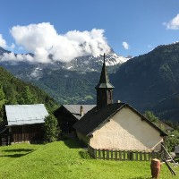
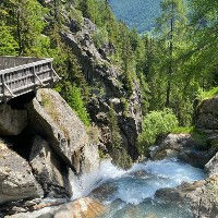
Points of Interest in and around Chamonix

Chamonix and the neighboring valleys have a lot to offer and there are many sights, attractions and points of interest worth visiting. Our site focuses on trail running and hiking in Chamonix, so naturally our selection of points of interests focus on the ones that are reachable using the trails featured on our website. For each of these points of interests we will provide photos, descriptions, key data and a map showing its exact location including GPS coordinates. For each point of interest, we will also list the trails on our website that you can take to visit them. You can use the search box below to search our database and find points of interest in and around the Chamonix valley based on their name, type and nearest town. Our Interactive Map is a great tool for finding points of interest based on their location.

Interactive Map

Title Keyword

Type

Nearest Town

# Items found

183 items found

Pointe Percee

The highest point of the Chaine des Aravis above Sallanches

Nearest Town

Sallanches

Altitude.png

Altitude

2750m / 9022ft

Col de Salenton

Mountain Pass between the Berard and Aiguilles Rouges natural reserves

Nearest Town

Vallorcine

Altitude.png

Altitude

2526m / 8287ft

Buvette de Berard

Great snack bar perched above the Cascade de Berard waterfall

Nearest Town

Vallorcine

Altitude.png

Altitude

1429m / 4688ft

Vaudagne

Vaudagne is a hamlet on the western side of the valley which is part of the town of Les Houches

Nearest Town

Les Houches

Altitude.png

Altitude

1021m / 3350ft

Cheminee des Fees Saint-Gervais

Fairy Chimney rock formation near Saint-Gervais-les-Bains

Nearest Town

Saint Gervais

Altitude.png

Altitude

940m / 3084ft

Chapelle Saint Theodule

Small Chapel for Saint Theodule in Les Tines with a rich history

Nearest Town

Chamonix

Altitude.png

Altitude

1088m / 3570ft

Cascade du Berard

Beautiful waterfall with little snack bar at the start of the Berard Valley.

Nearest Town

Vallorcine

Altitude.png

Altitude

1429m / 4688ft

Glacier du Tour

Glacier above the town of Le Tour with the trail to the Refuge Albert 1er enabling close access

Nearest Town

Le Tour

Altitude.png

Altitude

2550m / 8366ft

Refuge du Plan de Aiguille

Very nice refuge perched high above Chamonix along the Grand Balcon Nord

Nearest Town

Chamonix

Altitude.png

Altitude

2207m / 7241ft

Glacier Argentiere

This glacier lies above the town of Argentiere right next to the Grand Montets ski area

Nearest Town

Argentiere

Altitude.png

Altitude

1840m / 6037ft

If you know of a point of interest in or around the Chamonix Valley that you feel we should add to our website then we invite you to send us a message

Got something to add?

We got started in the spring of 2023 and we are working hard on making this site as complete and accurate as possible. We need your help! If you got anything you would like to add then please reach out to us.

Chamonix360 is a not a company or a commercial organization. The site is managed by a group of trail enthusiasts in Chamonix-Mont-Blanc

© 2024 Chamonix360  

bottom of page