

Chamonix Trails with Big Spectacular Views
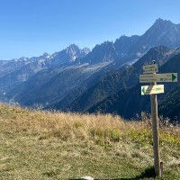
Big Mountains, Big Views! Many people come to Chamonix because it has the Mont Blanc and some of the highest peaks in Western Europe. The trails we list here have been hand picked for reaching View Points, Cols and Summits in and around Chamonix that provide spectacular views. We present two ways of findings these trails. Below we feature some pictures with nice big Views. If you see one you like, then click on it and it will show you where the picture was taken and which trails pass by that location.


Trails with Great Views in and around Chamonix
It is not hard to find amazing views in Chamonix. In fact the views from the Chamonix town center are already pretty breathtaking with the glaciers and the snow covered peaks all around you. The views get even much better once you gain some altitude and reach some of the plateaus around the valley floor. To appreciate Mont Blanc it is sometimes better to gain some more distance from it and see it from the peaks outside of the Chamonix valley. On this page we are featuring trails that we feel give the best views. Often these trails reach summits, ridges and/or cols that open up an amazing view of the mountains around you. We hand-picked these trails and we hope you will have a great time enjoying them.

Spectacular views on this one! The walk over the crest from Bellachat to Aiguillette des Houches is absolutely spectacular. Merlet makes for the easiest access without lifts.
Length
10.49km / 6.79mi
Nearest Town
Starting Point
Route Type
Les Houches
Park Merlet
Loop
Elevation +
1005m / 3297ft
Elevation -
1005m / 3297ft
Technical
Hike Duration
Run Duration
3-5 Hours
2-3.5 Hours
Beauty
Tags
Refuge, Big Views

A challenging route that takes you to the summit of Mont Buet at 3096m passing by the Refuge de Loriaz, the Col de la Terrasse and the Cheval Blanc
Length
23.31km / 14.48mi
Nearest Town
Starting Point
Route Type
Vallorcine
Le Buet Train Station
Loop
Elevation +
2048m / 6719ft
Elevation -
2048m / 6719ft
Technical
Hike Duration
Run Duration
8-13 Hours
5-8 Hours
Beauty
Tags
Lake, Snack Bar, Refuge, Big Views

Fantastic route with so much to offer and a great diversity of scenery and views. This trail can be done with children as long as they can handle the significant amount of downhill.
Length
10.99km / 6.82mi
Nearest Town
Starting Point
Route Type
Les Houches
Bellevue Lift Station
With Lift
Elevation +
651m / 2135ft
Elevation -
1278m / 4192ft
Technical
Hike Duration
Run Duration
3.5-6 Hours
2-3 Hours
Beauty
Tags
Family Friendly, Snack Bar, Big Views, Glacier, Refuge, With Lift

The easiest way to reach Lac Blanc using the Flegere and Index lifts and then travers to the Lac Blanc before heading back to Flegere. A Family friendly way of visiting Lac Blanc
Length
6.21km / 3.85mi
Nearest Town
Starting Point
Route Type
Argentiere
Index Lift Station
With Lift
Elevation +
178m / 583ft
Elevation -
667m / 2188ft
Technical
Hike Duration
Run Duration
2-3 Hours
1-2 Hours
Beauty
Tags
Big Views, Lake, Family Friendly, Refuge, Snack Bar, With Lift

A beautiful loop in the Montagne de Loriaz and the Montagne de Barberine taking you from Vallorcine to the Refuge de Loriaz and then traversing to the big Lac d'Emosson lake.
Length
13.25km / 8.23mi
Nearest Town
Starting Point
Route Type
Vallorcine
Vallorcine Train Station
Loop
Elevation +
1022m / 3353ft
Elevation -
1022m / 3353ft
Technical
Hike Duration
Run Duration
4-6 Hours
2.5-4 Hours
Beauty
Tags
Refuge, Big Views, Lake, Dogs

Beautiful family friendly trail at 2000 meters of altitude with amazing views of Mont Blanc with easy access thanks to the Flegere and Planpraz Gondolas.
Length
5.64km / 3.50mi
Nearest Town
Starting Point
Route Type
Chamonix
Flegere Gondola
With Lift
Elevation +
314m / 1030ft
Elevation -
191m / 626ft
Technical
Hike Duration
Run Duration
1.5-2 hours
45-75 Mins
Beauty
Tags
Big Views, Family Friendly, Snack Bar, With Lift

A tough but beautiful trail that takes you from the Col des Montets upto Lac Blanc and from there you traverse the Aiguilles Rouges and visit Lacs Noirs and Lac Cornu
Length
16.45km / 10.22mi
Nearest Town
Starting Point
Route Type
Le Tour
Col des Montets
With Lift
Elevation +
1552m / 5091ft
Elevation -
1011m / 3320ft
Technical
Hike Duration
Run Duration
7-12 Hours
4-6 Hours
Beauty
Tags
Refuge, Snack Bar, Lake, Big Views, With Lift

A bit far from Chamonix and not easy to get to but I had to explore this iconic rock peak towering above Sallanches that you pass by on your way to the Chamonix Valley
Length
9.48km / 6.11mi
Nearest Town
Starting Point
Route Type
Sallanches
Col des Annes
Point to point
Elevation +
1038m / 3405ft
Elevation -
1038m / 3405ft
Technical
Hike Duration
Run Duration
4-8 Hours
3-5 Hours
Beauty
Tags
Refuge, Big Views

An amazing route that takes you deep into the nature reserve of Passy and the Vallon de Berard. There are no towns or paved roads in these valleys so its a pure natural experience.
Length
25.66km / 15.94mi
Nearest Town
Starting Point
Route Type
Vallorcine
Le Buet Train Station
Point to point
Elevation +
1489m / 4885ft
Elevation -
2105m / 6909ft
Technical
Hike Duration
Run Duration
7-11 Hours
4-6 Hours
Beauty
Tags
Refuge, Snack Bar, Lake, Big Views, Waterfall
This is a short route starting at the top of the Bellevue lift and traversing Mont Lachat till you reach its summit. Nice views of the entire Chamonix valley and Mont Blanc
Length
3.88km / 2.41mi
Nearest Town
Starting Point
Route Type
Les Houches
Bellevue Lift Station
With Lift
Elevation +
311m / 1020ft
Elevation -
311m / 1020ft
Technical
Hike Duration
Run Duration
1.5-2.5 Hours
45-75 Mins
Beauty
Tags
Snack Bar, Big Views, Family Friendly, Dogs, With Lift

A well-known classic route for exploring the Fiz mountain range. The trail offers a nice variation in scenery with great views of the Mont Blanc and multiple valleys and well-known peaks.
Length
31.5km / 19.5mi
Nearest Town
Starting Point
Route Type
Servoz
Plaine Joux (Passy)
Loop
Elevation +
2076m / 6811ft
Elevation -
2076m / 6811ft
Technical
Hike Duration
Run Duration
9-14 Hours
5-7 Hours
Beauty
Tags
Lake, Refuge, Snack Bar, Big Views, Waterfall

One of the classic routes in Chamonix which takes you to the junction where the glaciers of Bosson and Taconnaz split. Fantasic up-close views of Mont Blanc
Length
14.98km / 9.30mi
Nearest Town
Starting Point
Route Type
Chamonix
Les Bossons
Out and Back
Elevation +
1561m / 5121ft
Elevation -
1561m / 5121ft
Technical
Hike Duration
Run Duration
7-9 Hours
3-5 Hours
Beauty
Tags
Snack Bar, Big Views, Glacier

A wonderful exploration trail getting up close with the Glacier d'Argentiere and a visit to the Chalet Refuge de Lognan. Amazing views and a spectacular glacier.
Length
6.3km / 3.91m
Nearest Town
Starting Point
Route Type
Argentiere
Plan Joran Lift
Loop
Elevation +
474m / 1555ft
Elevation -
474m / 1555ft
Technical
Hike Duration
Run Duration
2-3 Hours
1.25-2 Hours
Beauty
Tags
Refuge, Glacier, Dogs, Big Views, With Lift

This route takes you from the village of Le Tour to the high altitude refuge Albert 1er, right next to the Glacier du Tour
Length
9.31km / 5.78mi
Nearest Town
Starting Point
Route Type
Le Tour
Le Tour
Out and back
Elevation +
862m / 2828ft
Elevation -
862m / 2828ft
Technical
Hike Duration
Run Duration
3-5 Hours
1.5-2.5 Hours
Beauty
Tags
Refuge, Glacier, Big Views, With Lift

A little off the beaten track with nice views and towards both sides of the valley. Trail starts and ends at Le Planet near Argentiere.
Length
7.54km / 4.68mi
Nearest Town
Starting Point
Route Type
Argentiere
Le Planet
Loop
Elevation +
612m / 2007ft
Elevation -
612m / 2007ft
Technical
Hike Duration
Run Duration
2-3 Hours
1.5-2 Hours
Beauty
Tags
Big Views, Glacier
The Best Trails in Chamonix in other categories
We have many other categories for our selection of the best hiking and trail running trails in Chamonix. Just like this list, all these categories feature hand-picked trails which we feel are the best for that specific category. Have a look at any of these to find your perfect trail.
Lastly, we also have a page that showcases all the trails in our database in text format. This enables you to quickly compare trails and order them by length, elevation gain, name and starting point.