

Family Friendly Trails in Chamonix
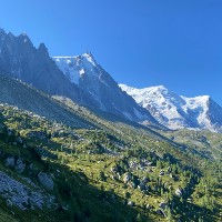
Chamonix is a high altitude destination with steep mountains and rough terrain. So taking your kids on a nice long hike might seem daunting. Luckily there are very nice options for families with children and the Chamonix lift system makes it possible to take your children to some pretty spectacular places. We present two ways of findings these trails. Below we feature some pictures of Family Friendly trails. If you see one you like, then click on it and it will show you where the picture was taken and which trails pass by that location.


Kid & Family Friendly Trails around Chamonix
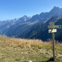
Below you will find our personal selection of the best Family Friendly Trails in and around Chamonix. This means that these trails can be enjoyed by the entire family, including children. Just because we consider them Child Friendly, does not automatically mean that these are short walks or walks that only stay on the valley floor. Some of these are quite long and quite strenuous. You also always have to mind your children carefully when taking them up to the mountains. The mountains around Chamonix are steep and often trails will be rocky or have a drop on one side. If you are carrying children in a carrier then make sure to use poles for additional balance or adjust your plans and wait for your children to grow up before tackling some of the more technical routes. Some chair lifts, gondolas and cable cars in Chamonix furthermore have rules around babies, infants and toddlers for riding the different types of lifts around the valley. Check this ahead of time with the tourism support organizations of Chamonix. If you want to narrow down your search, then Press Detailed Search to search our full database on a wide range of parameters including family and dog friendly.

A small but beautiful little loop walk near Le Buet featuring the Berard waterfall and snack bar, the Farinet cave and trails lined with wooden sculptures
Length
3.33km / 2.06mi
Elevation +
116m / 380.57
Hike Duration
50-80 Mins
Nearest Town
Vallorcine
Elevation -
116m / 380.57
Run Duration
25-40 Mins
Starting Point
Route Type
Length
Le Buet Train Station
Technical
Scenic Beauty
Loop
Waterfall, Snack Bar, Family Friendly, Dogs, Low Altitude

The Gorges de la Diosaz is a beautiful ravine with a a river and smaller and bigger waterfalls. Almost the entire walk is done using wooden bridgeways attached to the cliff sides.
Length
1.8km / 1.11mi
Elevation +
190m / 623ft
Hike Duration
45-75 Mins
Nearest Town
Servoz
Elevation -
190m / 623ft
Run Duration
45-75 Mins
Starting Point
Route Type
Length
Gorges de la Diosaz Park
Technical
Scenic Beauty
Out and Back
Waterfall, Family Friendly, Snack Bar, Park
Perhaps the most popular route in the Chamonix Valley taking you from the Montenvers station and the Mer de Glace over the Balcon Nord past the Lac Bleu to the Plan l'Aiguille lift station.
Length
7.35km / 4.56mi
Elevation +
471m / 1545ft
Hike Duration
2-3.5 Hours
Nearest Town
Chamonix
Elevation -
103m / 338ft
Run Duration
1-1.5 Hours
Starting Point
Route Type
Length
Montenvers Train Station
Technical
Scenic Beauty
With Lift
Big Views, Refuge, Snack Bar, Family Friendly, Lake, Glacier, With Lift

A short but very worthwhile little trail with nice views of the Rochers des Mottets. The trail ends at the Le Chapeau Buvette where you can enjoy a variety of snacks and drinks
Length
2.89km / 1.79mi
Elevation +
303m / 994ft
Hike Duration
45-75 Mins
Nearest Town
Chamonix
Elevation -
303m / 994ft
Run Duration
25-45 Mins
Starting Point
Route Type
Length
Le Lavancher
Technical
Scenic Beauty
Out and Back
Snack Bar, Big Views, Waterfall, Low Altitude, Family Friendly, Dogs

A short, family friendly, but slightly steep loop with a visit to the Gorges Mysterieuses and the Grotte aux Nymphes. A steep ravine with a cave and multi-level waterfalls.
Length
2.84km / 1.76mi
Elevation +
346m / 1135ft
Hike Duration
1-1.5 Hours
Nearest Town
Finhaut
Elevation -
346m / 1135ft
Run Duration
30-45 Mins
Starting Point
Route Type
Length
Tete Noir Parking
Technical
Scenic Beauty
Loop
Family Friendly, Dogs, Low Altitude, Waterfall

The easiest way to reach Lac Blanc using the Flegere and Index lifts and then travers to the Lac Blanc before heading back to Flegere. A Family friendly way of visiting Lac Blanc
Length
6.21km / 3.85mi
Elevation +
178m / 583ft
Hike Duration
2-3 Hours
Nearest Town
Argentiere
Elevation -
667m / 2188ft
Run Duration
1-2 Hours
Starting Point
Route Type
Length
Index Lift Station
Technical
Scenic Beauty
With Lift
Big Views, Lake, Family Friendly, Refuge, Snack Bar, With Lift

A short, family-friendly trail from the Grepon Parking near Chamonix Sud brings you to the Cascade du Dard. A nice waterfall with a nice Buvette right next to it.
Length
3.38km / 2.1mi
Elevation +
284m / 931ft
Hike Duration
1-1.5 Hours
Nearest Town
Chamonix
Elevation -
284m / 931ft
Run Duration
30-45 Mins
Starting Point
Route Type
Length
Grepon Parking
Technical
Scenic Beauty
Out and Back
Waterfall, Snack Bar, Low Altitude, Family Friendly, Dogs

Beautiful family friendly trail at 2000 meters of altitude with amazing views of Mont Blanc with easy access thanks to the Flegere and Planpraz Gondolas.
Length
5.64km / 3.50mi
Elevation +
314m / 1030ft
Hike Duration
1.5-2 hours
Nearest Town
Chamonix
Elevation -
191m / 626ft
Run Duration
45-75 Mins
Starting Point
Route Type
Length
Flegere Gondola
Technical
Scenic Beauty
With Lift
Big Views, Family Friendly, Snack Bar, With Lift

This is a very nice, family friendly discovery loop exploring the villages of Argentiere, Le Planet, Montroc and Tre-le-Champ and the many points of interest along the way.
Length
7.57km / 4.70mi
Elevation +
325m / 1066ft
Hike Duration
2-3 Hours
Nearest Town
Argentiere
Elevation -
325m / 1066ft
Run Duration
1-1.5 Hours
Starting Point
Route Type
Length
Argentiere Town Center
Technical
Scenic Beauty
Loop
Dogs, Family Friendly, Snack Bar, Low Altitude

A short little trail from Plaine Joux to the very beautiful Lac Vert above Servoz including a loop around the lake before heading back
Length
3.45km / 2.14mi
Elevation +
85m / 278ft
Hike Duration
1-2 Hours
Nearest Town
Servoz
Elevation -
85m / 278ft
Run Duration
40-60 Mins
Starting Point
Route Type
Length
Plaine Joux
Technical
Scenic Beauty
Out and Back
Lake, Snack Bar, Dogs, Family Friendly

Fantastic route with so much to offer and a great diversity of scenery and views. This trail can be done with children as long as they can handle the significant amount of downhill.
Length
10.99km / 6.82mi
Elevation +
651m / 2135ft
Hike Duration
3.5-6 Hours
Nearest Town
Les Houches
Elevation -
1278m / 4192ft
Run Duration
2-3 Hours
Starting Point
Route Type
Length
Bellevue Lift Station
Technical
Scenic Beauty
With Lift
Family Friendly, Snack Bar, Big Views, Glacier, Refuge, With Lift
This is a short route starting at the top of the Bellevue lift and traversing Mont Lachat till you reach its summit. Nice views of the entire Chamonix valley and Mont Blanc
Length
3.88km / 2.41mi
Elevation +
311m / 1020ft
Hike Duration
1.5-2.5 Hours
Nearest Town
Les Houches
Elevation -
311m / 1020ft
Run Duration
45-75 Mins
Starting Point
Route Type
Length
Bellevue Lift Station
Technical
Scenic Beauty
With Lift
Snack Bar, Big Views, Family Friendly, Dogs, With Lift

La Floria is a Snack Bar perched above the Chamonix golf course with a nice view over the valley and the Aguille Vert and Mont Blanc range
Length
5.5km / 3.41mi
Elevation +
298m / 977ft
Hike Duration
75-100 Mins
Nearest Town
Chamonix
Elevation -
298m / 977ft
Run Duration
40-60 Mins
Starting Point
Route Type
Length
Chamonix Tennis Parking
Technical
Scenic Beauty
Out and Back
Dogs, Low Altitude, Snack Bar, Family Friendly

A short but beautiful trail from Les Bois to les Sources de l'Arveyron. A viewing deck with nice views into the Chamonix valley at the end of the Mer de Glace
Length
3.47km / 2.15mi
Elevation +
206m / 675ft
Hike Duration
1-1.5 Hours
Nearest Town
Chamonix
Elevation -
206m / 675ft
Run Duration
25-45 Mins
Starting Point
Route Type
Length
Les Bois
Technical
Scenic Beauty
Loop
Dogs, Family Friendly, Low Altitude
A short route that offers an amazing variety of scenery including the Chavants lake, the picturesque village of Vaudagne and ends at nice alpine pastures with nice views of Mt. Blanc.
Length
6.27km / 3.9mi
Elevation +
306m / 1003ft
Hike Duration
1-2 Hours
Nearest Town
Les Houches
Elevation -
306m / 1003ft
Run Duration
40-60 Mins
Starting Point
Route Type
Length
Lac Chavants
Technical
Scenic Beauty
Loop
Snack Bar, Lake, Family Friendly, Low Altitude, Dogs
The Best Trails in Chamonix in other categories
We have many other categories for our selection of the best hiking and trail running trails in Chamonix. Just like this list, all these categories feature hand-picked trails which we feel are the best for that specific category. Have a look at any of these to find your perfect trail.
Lastly, we also have a page that showcases all the trails in our database in text format. This enables you to quickly compare trails and order them by length, elevation gain, name and starting point.