

Chamonix Trails that stay close to the Valley Floor
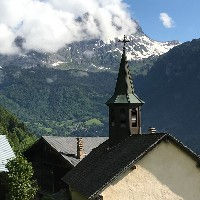
Chamonix is located in a beautiful valley and you don't always have to go up high into the mountains to enjoy a good hike or run. There are beautiful trails through forests and along side rivers that are definitely worthwhile. In this segment we will present the best trails in Chamonix that stay on the valley floor or at low altitude. Some of the trails we will feature here will have some elevation gain in them and many of these will reach nice view points or points of interest. We tried to keep the elevation gain limited though to make sure that these trails remain family friendly and fairly casual. Below we feature some pictures of these trails. If you see one you like, then click on it and it will show you where the picture was taken and which trails pass by that location.


Chamonix Valley Floor and Low Altitude Trails
The Chamonix Valley is flanked by fairly steep mountains on both sides but luckily the valley itself is quite wide. Chamonix itself is also a fairly large town. The Arve river runs through the valley and there are nice wooded areas on the valley floor mostly around Les Praz and Les Bois. The Mer de Glace glacier ends at les Bois where it forms the Arveyron river and that area is absolutely beautiful with large rocks and nice crests. On both sides of the valley you have the lower balcons, the Petite Balcon Sud and the Petite Balcon Nord. These balcons run at low altitude and enable a wide range of low altitude routes. These balcons also connect the towns and hamlets inside the Chamonix valley including Les Houches, Les Bosson, Taconnaz, Chamonix, Les Praz, Les Bois, Les Tines, la Joux, Argentiere and Le Tour. All of these can be visited by using the lower balcons and the valley floor trails. This is our collection of the best low altitude and valley floor trails in Chamonix. If you want to do a more detailed trail search then press the search our full database button.

A short but very worthwhile little trail with nice views of the Rochers des Mottets. The trail ends at the Le Chapeau Buvette where you can enjoy a variety of snacks and drinks
Length
Nearest Town
Starting Point
Route Type
2.89km / 1.79mi
Chamonix
Le Lavancher
Out and Back
Elevation +
303m / 994ft
Elevation -
303m / 994ft
Difficulty
Hike Duration
Run Duration
45-75 Mins
25-45 Mins
Scenic Beauty
Tags
Snack Bar, Big Views, Waterfall, Low Altitude, Family Friendly, Dogs

A short, family-friendly trail from the Grepon Parking near Chamonix Sud brings you to the Cascade du Dard. A nice waterfall with a nice Buvette right next to it.
Length
Nearest Town
Starting Point
Route Type
3.38km / 2.1mi
Chamonix
Grepon Parking
Out and Back
Elevation +
284m / 931ft
Elevation -
284m / 931ft
Difficulty
Hike Duration
Run Duration
1-1.5 Hours
30-45 Mins
Scenic Beauty
Tags
Waterfall, Snack Bar, Low Altitude, Family Friendly, Dogs
A short route that offers an amazing variety of scenery including the Chavants lake, the picturesque village of Vaudagne and ends at nice alpine pastures with nice views of Mt. Blanc.
Length
Nearest Town
Starting Point
Route Type
6.27km / 3.9mi
Les Houches
Lac Chavants
Loop
Elevation +
306m / 1003ft
Elevation -
306m / 1003ft
Difficulty
Hike Duration
Run Duration
1-2 Hours
40-60 Mins
Scenic Beauty
Tags
Snack Bar, Lake, Family Friendly, Low Altitude, Dogs

La Floria is a Snack Bar perched above the Chamonix golf course with a nice view over the valley and the Aguille Vert and Mont Blanc range
Length
Nearest Town
Starting Point
Route Type
5.5km / 3.41mi
Chamonix
Chamonix Tennis Parking
Out and Back
Elevation +
298m / 977ft
Elevation -
298m / 977ft
Difficulty
Hike Duration
Run Duration
75-100 Mins
40-60 Mins
Scenic Beauty
Tags
Dogs, Low Altitude, Snack Bar, Family Friendly

Low altitude, easy and family friendly trail that takes you from Le Tour, to Argentiere to Le Lavancher and ends up in Chamonix using the Petit Balcon Nord (PBN)
Length
Nearest Town
Starting Point
Route Type
12.53km / 7.78mi
Le Tour
Le Tour
Point to Point
Elevation +
226m / 741ft
Elevation -
683m / 2244ft
Difficulty
Hike Duration
Run Duration
2.5-4 Hours
1.5-2.5 Hours
Scenic Beauty
Tags
Dogs, Family Friendly, Low Altitude

A short but beautiful trail from Les Bois to les Sources de l'Arveyron. A viewing deck with nice views into the Chamonix valley at the end of the Mer de Glace
Length
Nearest Town
Starting Point
Route Type
3.47km / 2.15mi
Chamonix
Les Bois
Loop
Elevation +
206m / 675ft
Elevation -
206m / 675ft
Difficulty
Hike Duration
Run Duration
1-1.5 Hours
25-45 Mins
Scenic Beauty
Tags
Dogs, Family Friendly, Low Altitude

A nice route through a large part of the Montjoie Valley passing through numerous little hamlets and nice open fields with nice views all around.
Length
Nearest Town
Starting Point
Route Type
9.7km / 6.02mi
Saint Gervais
Saint-Gervais
Point to point
Elevation +
554m / 1817ft
Elevation -
197m / 646ft
Difficulty
Hike Duration
Run Duration
3-4 Hours
1.5-2 Hours
Scenic Beauty
Tags
Family Friendly, Dogs, Low Altitude, Lake, Snack Bar

The Petit Balcon Sud (PBS) runs from Argentiere to Chamonix and further down the valley. This section of the PBS takes you from Argentiere to Chamonix
Length
Nearest Town
Starting Point
Route Type
8.83km / 5.48mi
Argentiere
Argentiere Train Station
Point to point
Elevation +
201m / 659ft
Elevation -
415m / 1362ft
Difficulty
Hike Duration
Run Duration
2-3 Hours
1-1.5 Hours
Scenic Beauty
Tags
Dogs, Low Altitude, Family Friendly
The Best Trails in Chamonix in other categories
We have many other categories for our selection of the best hiking and trail running trails in Chamonix. Just like this list, all these categories feature hand-picked trails which we feel are the best for that specific category. Have a look at any of these to find your perfect trail.
Lastly, we also have a page that showcases all the trails in our database in text format. This enables you to quickly compare trails and order them by length, elevation gain, name and starting point.